If you’ve noticed more discussions about El Niño lately, there’s a good reason for it.
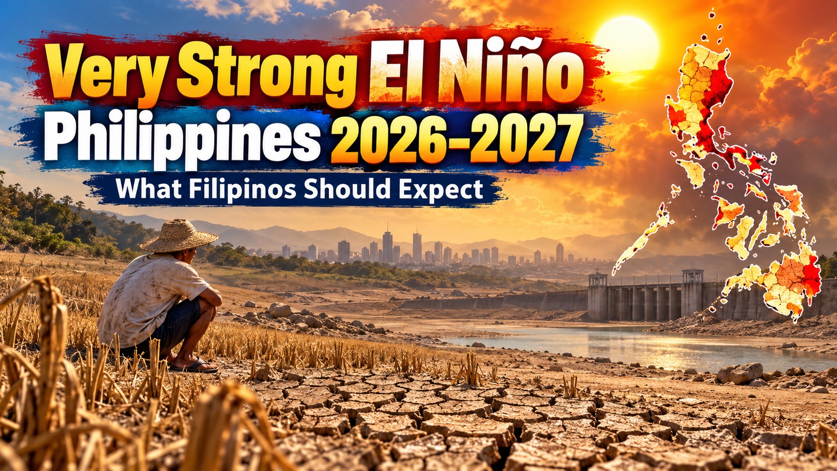
The El Niño affecting the Philippines in 2026 is getting stronger — and weather agencies are now warning that it could become a very strong El Niño before the end of the year.
For Filipinos, this isn’t just something happening thousands of kilometers away in the Pacific Ocean.
A strong El Niño can eventually affect the amount of rain we receive, how hot it feels, water levels in dams, farms and food production, electricity demand and even the likelihood of drought in different parts of the country.
And this particular El Niño could be a significant one.
As of early October 2026, PAGASA says a strong El Niño is already active in the tropical Pacific and is expected to intensify into a very strong event before the end of 2026. The agency expects El Niño conditions to persist through the first half of 2027.
The World Meteorological Organization has also warned that the event is expected to become very strong and peak toward the end of 2026, with climate impacts continuing well into 2027.
So what exactly does that mean for ordinary Filipinos?
Here’s what we know so far.
Content
Is There Really a Very Strong El Niño in 2026–2027?
Yes — although there’s an important distinction.
As of early October 2026, PAGASA describes the current El Niño as strong.
The “very strong” classification refers to what climate models expect the event to become as it intensifies toward the final months of 2026.
PAGASA issued a climate advisory on September 23 warning that the strong El Niño currently affecting the tropical Pacific is expected to intensify into a very strong El Niño and persist through the first half of 2027.
NOAA’s Climate Prediction Center is even more specific.
Its September outlook placed the probability of a very strong El Niño during the Northern Hemisphere fall and winter of 2026–2027 at greater than 90%. NOAA also estimated a 75% chance during the October-November-December period that the event could reach a magnitude exceeding previous El Niño events in its historical record going back to 1950, based on its Relative Oceanic Niño Index measure.
Meanwhile, the World Meteorological Organization says there is an exceptionally high likelihood — close to 100% — that El Niño will continue through February 2027.
In other words, this isn’t simply a long-range prediction anymore.
El Niño is already here.
The question now is how strong it becomes and exactly how its effects will play out across the Philippines.
What Is El Niño?
El Niño is the warm phase of a natural climate pattern called the El Niño-Southern Oscillation or ENSO.
During El Niño, sea surface temperatures across portions of the central and eastern equatorial Pacific Ocean become unusually warm.
That might sound far removed from life in the Philippines, but the Pacific Ocean plays a huge role in controlling weather patterns across our part of the world.
Changes in ocean temperatures can alter atmospheric circulation, rainfall patterns and tropical weather.
For the Philippines, El Niño is generally associated with a higher likelihood of:
- Below-normal rainfall
- Longer dry periods
- Dry spells and drought
- Warmer temperatures
- Agricultural water shortages
- Lower water availability in some reservoirs
- Increased heat and water stress
But there’s one thing that needs to be emphasized.
El Niño does not mean it will stop raining.
El Niño Doesn’t Mean “No Rain”
This is probably one of the biggest misconceptions about El Niño.
You can have El Niño and still experience thunderstorms, tropical cyclones, flooding and days of extremely heavy rain.
We already saw an example of this in 2026.
While El Niño was underway, parts of Luzon experienced persistent heavy rainfall in late August after the Southwest Monsoon was enhanced by a low-pressure area. PAGASA recorded more than 300 millimeters of rain over three days at its Science Garden station.
PAGASA itself has warned that despite the overall tendency toward drier conditions, the Habagat and tropical cyclones can still produce periods of locally heavy or even above-normal rainfall, particularly over western portions of the country.
So don’t think of El Niño as a switch that turns rainfall off.
It’s better to think of it as something that shifts the odds.
Over several months, many areas may receive less rainfall than they normally would — even though individual storms can still produce flooding.
When Will the Strongest El Niño Effects Be Felt?
The most important period to watch appears to be late 2026 through the early months of 2027.
PAGASA expects the ongoing El Niño to reach very strong intensity before the end of 2026 and persist into the first half of 2027.
NOAA expects El Niño to continue strengthening toward the end of the year, with a greater than 90% chance of a very strong event during late 2026 into the 2026–2027 Northern Hemisphere winter.
That means the effects Filipinos should pay particularly close attention to include the transition from late 2026 into the traditionally drier months of early 2027.
If rainfall becomes increasingly deficient over several consecutive months, that’s when concerns about soil moisture, agriculture, reservoirs and water supply can become more serious.
1. Below-Normal Rainfall in Many Areas
This is likely to be the most important impact.
PAGASA says El Niño increases the likelihood of below-normal rainfall across much of the Philippines.
Its September advisory specifically warns that prolonged rainfall deficits could lead to severe agricultural dry spells and greater pressure on water resources.
And current shorter-range forecasts are already showing the kind of pattern people should monitor.
For October 11 to 24, for example, PAGASA’s subseasonal forecasts indicated an increased probability of below-normal rainfall over most parts of the country, although some areas could still receive above-normal rainfall.
That doesn’t mean every province will become dry at exactly the same time.
Rainfall conditions can differ dramatically between Luzon, Visayas and Mindanao — and even between neighboring provinces.
But if the El Niño remains very strong for months, rainfall deficits can accumulate.
And that’s when a few dry weeks can become something much more serious.
2. More Areas Could Experience Dry Spells and Drought
You’ve probably heard PAGASA use three different terms:
Dry condition.
Dry spell.
Drought.
They’re not interchangeable.
PAGASA defines a dry condition as two consecutive months with rainfall around 21% to 60% below normal.
A dry spell generally means three consecutive months with rainfall 21% to 60% below normal, or two consecutive months with rainfall more than 60% below normal.
Drought is more prolonged: either three consecutive months of rainfall more than 60% below normal or five consecutive months with rainfall 21% to 60% below normal.
This is why the length of El Niño matters.
A single dry month isn’t automatically drought.
But when unusually low rainfall continues month after month, the situation becomes progressively more serious.
And with El Niño expected to persist into the first half of 2027, this accumulated rainfall deficit is something worth watching closely.
3. Hotter-Than-Usual Conditions
El Niño isn’t only about rain.
Temperature is another concern.
PAGASA expects near-average to warmer-than-average temperatures across most of the Philippines, while its early October subseasonal forecast showed significantly warmer-than-usual conditions in portions of Central Luzon and northern Quezon and slightly warmer to warmer conditions across much of the rest of the country.
This doesn’t necessarily mean every day will break temperature records.
We could still get cooler periods, especially once the Amihan becomes established over parts of the country.
What El Niño does is increase the likelihood that temperatures over longer periods will lean warmer than normal.
And if that continues into March, April and May 2027 — normally some of the hottest months in the Philippines anyway — heat could become an even bigger concern.
4. Water Supply Could Come Under Pressure
This is one of the impacts people in cities tend to notice the most.
If rainfall remains deficient for several months, rivers, watersheds and reservoirs may receive less water.
That can eventually affect water available for:
- Homes
- Farms
- Irrigation
- Industry
- Hydroelectric power generation
It doesn’t automatically mean Metro Manila or other cities will experience water interruptions.
Reservoir levels depend on many factors, including how much rain falls in specific watersheds, water consumption and how dams are managed.
But prolonged El Niño conditions can increase the risk of water stress.
This is exactly why PAGASA is urging government agencies and the public to begin conservation and mitigation efforts before the most severe effects are felt.
In practical terms, conserving water becomes more important the longer dry conditions persist.
5. Agriculture Could Be One of the Hardest-Hit Sectors
This is where El Niño can eventually affect even Filipinos living far away from farms.
Rice, corn, vegetables, fruits, livestock and other agricultural products all depend on reliable water supplies.
Rainfed farms are especially vulnerable.
PAGASA has already reported moisture deficits affecting crop areas during the current El Niño, noting that rainfed rice and corn can be particularly vulnerable to moisture stress during critical growing stages.
If rainfall deficits become more severe, farmers could face:
- Delayed planting
- Reduced soil moisture
- Greater irrigation demand
- Lower crop yields
- Livestock heat stress
- Higher production costs
And once farm production is affected, the consequences can eventually reach markets.
Reduced supply can contribute to upward pressure on food prices, although actual prices will also depend on imports, government intervention, inventories, transportation costs and many other factors.
So El Niño doesn’t automatically mean that rice or vegetables will suddenly become expensive.
But prolonged drought increases the risk.
6. Farmers May Need to Adjust Planting Schedules
One of PAGASA’s repeated recommendations to the agriculture sector is to use climate forecasts when planning crops.
This becomes especially important during a strong or very strong El Niño.
Farmers may need to adjust planting schedules depending on expected rainfall and irrigation availability.
Water-efficient practices could also become more important, especially in areas dependent on rain instead of large irrigation systems.
Crop selection may change in some locations as well.
The exact response should depend on local conditions, which is why provincial and municipal forecasts are more useful to farmers than simply hearing that “El Niño is coming.”
PAGASA has encouraged the use of localized climate information and tools that allow communities to examine climate conditions at much smaller geographic scales.
7. Electricity Demand Could Increase
There’s another impact that often gets overlooked: electricity.
Hotter conditions usually mean more Filipinos using:
- Air conditioners
- Electric fans
- Refrigeration
- Cooling systems in offices and commercial buildings
That can increase electricity demand, particularly during hot afternoons.
At the same time, prolonged low rainfall can reduce water available for some hydroelectric facilities.
This doesn’t mean El Niño automatically causes brownouts.
Electricity supply depends on power plant availability, reserves, transmission systems, demand and the country’s overall power mix.
But a combination of high temperatures, stronger cooling demand and lower water availability can add pressure to the electricity system.
8. Heat-Related Health Problems Could Become More Common
Long periods of hot weather aren’t simply uncomfortable.
They can become a health risk.
People working outdoors are among the most vulnerable, including:
- Construction workers
- Farmers
- Delivery riders
- Traffic personnel
- Street vendors
- Commuters spending long periods outdoors
Children, older adults and people with certain medical conditions can also be more vulnerable to extreme heat.
During very hot days, dehydration, heat exhaustion and heat stroke become bigger concerns.
So if El Niño contributes to hotter-than-normal conditions heading into 2027, heat index forecasts will become something Filipinos should follow closely.
9. Grass and Forest Fires Could Become Easier to Start
Long stretches of dry weather can leave grasslands, vegetation and agricultural areas much drier.
And once vegetation becomes dry, fires can spread more easily.
The risk becomes greater when you combine:
- Little rain
- High temperatures
- Low soil moisture
- Dry vegetation
- Strong winds
That means communities should be particularly careful with open burning, discarded cigarettes and fires used for clearing vegetation during extended dry periods.
10. There Can Still Be Typhoons During El Niño
Another common misconception:
“El Niño means no typhoons.”
That’s not true.
El Niño can alter where tropical cyclones form, how frequently they develop and the tracks they take across the western Pacific.
But tropical cyclones can still enter the Philippine Area of Responsibility and affect the country.
PAGASA has specifically reminded the public that tropical cyclone activity can still bring heavy rainfall even during El Niño.
And a season with fewer storms doesn’t necessarily mean a safer season.
It only takes one powerful typhoon crossing a populated area to cause enormous damage.
So even during drought conditions, Filipinos still need to prepare for tropical cyclones, flash floods and landslides whenever weather systems develop.
How Can There Be Flooding During a Drought?
It sounds contradictory, but it can happen.
Drought is measured over months.
Flooding can happen in hours.
Imagine an area receiving much less rainfall than normal from November through February.
That area could technically be experiencing a drought.
Then one strong tropical system arrives and dumps a huge amount of rain over two days.
You can suddenly have flooding even though the longer-term rainfall total remains below normal.
That’s why both things can happen during the same El Niño period.
This distinction is especially important in the Philippines because heavy tropical rainfall can be extremely concentrated.
Which Parts of the Philippines Will Be Most Affected?
There isn’t a simple answer like “Luzon will be dry and Mindanao will not.”
El Niño affects rainfall differently depending on:
- Location
- Season
- Monsoon conditions
- Tropical cyclone activity
- Local terrain
- Prevailing winds
Even during El Niño, one province may experience serious rainfall deficits while another receives near-normal or above-normal rainfall.
PAGASA also noted that western portions of the country could still experience above-normal rainfall during the Habagat season even with El Niño underway.
So whenever you see national headlines saying “Philippines to experience drought,” remember that local conditions matter.
Always check your province’s actual rainfall and drought outlook.
Could This Become a Historic El Niño?
Possibly.
NOAA’s September 2026 outlook says there is a 75% chance that the October-November-December 2026 period could reach a Relative Oceanic Niño Index of at least +2.5°C — potentially exceeding previous events in NOAA’s record going back to 1950 under that particular measure.
That’s extraordinary.
But there is another important point.
The strength of El Niño in the Pacific doesn’t automatically tell us exactly how severe every impact will be in the Philippines.
Even two El Niño events with similar ocean temperatures can produce different rainfall patterns.
NOAA specifically cautions that even very strong events do not guarantee the typical El Niño effects everywhere.
So we shouldn’t assume that 2026–2027 will automatically duplicate previous major El Niño episodes.
Climate forecasts deal in probabilities, not guarantees.
How Long Will the 2026–2027 El Niño Last?
The latest outlook suggests El Niño will remain with us well into 2027.
PAGASA expects the event to persist through the first half of 2027.
NOAA’s official September probabilities show El Niño remaining virtually certain through the December-January-February and January-February-March periods.
Its probability then begins dropping during spring 2027, falling to 82% for March-April-May and 43% for April-May-June as the chances of ENSO-neutral conditions increase.
That doesn’t mean El Niño will suddenly disappear on a specific day.
ENSO transitions happen gradually.
It also means climate impacts can sometimes continue even while the Pacific begins shifting toward neutral conditions.
What Should Filipino Households Do?
There’s no reason to panic.
But there are plenty of practical things households can start doing.
Conserve water
Fix leaking faucets, avoid unnecessary water use and reuse water safely where practical.
Small conservation measures don’t seem dramatic, but they become important if reservoirs begin declining after several dry months.
Prepare for hotter days
Make sure family members — particularly children and older adults — have regular access to drinking water.
Avoid unnecessary exposure to extreme afternoon heat.
Monitor PAGASA advisories
Seasonal forecasts tell us the general pattern.
Daily and weekly forecasts tell us what is actually happening.
Both matter.
Don’t ignore rain warnings
Being in an El Niño doesn’t protect you from floods.
If PAGASA issues heavy rainfall, tropical cyclone or thunderstorm warnings, take them seriously.
Avoid unnecessary burning
Dry grass and vegetation can allow small fires to spread quickly.
Farmers should follow local forecasts
National El Niño headlines aren’t enough for agricultural planning.
Farmers should follow rainfall forecasts and advisories for their specific area and coordinate with agriculture and irrigation authorities where possible.
What About Summer 2027?
This could become one of the biggest questions heading into next year.
El Niño is expected to continue into the first half of 2027, although forecasts suggest its probability should decline as we move further into the year.
March, April and May are already normally hot months in the Philippines.
If El Niño-related warmer and drier conditions remain influential during that period, parts of the country could face increased heat and water stress.
But it’s too early to say exactly how hot individual cities will become or which provinces will experience drought during the peak of summer.
Those details will become much clearer as PAGASA issues updated rainfall, temperature and drought assessments closer to 2027.
Very Strong El Niño Philippines 2026–2027: Quick Summary
Here’s the situation as of early October 2026:
- A strong El Niño is already active.
- PAGASA expects it to intensify into a very strong El Niño before the end of 2026.
- El Niño is expected to continue through the first half of 2027.
- NOAA puts the probability of a very strong event during late 2026 into winter 2026–2027 above 90%.
- WMO says the likelihood of El Niño continuing through February 2027 is close to 100%.
- Below-normal rainfall is expected to become a major concern.
- Dry spells and drought could affect more areas if rainfall deficits persist.
- Warmer-than-normal temperatures are likely in many locations.
- Agriculture, water resources, energy and public health could come under increased pressure.
- El Niño does not mean there will be no rain or typhoons.
- Heavy rainfall and flooding can still occur even during prolonged dry conditions.
Frequently Asked Questions
Is the Philippines under El Niño right now?
Yes. PAGASA says strong El Niño conditions are currently active in the tropical Pacific as of its September 23, 2026 climate advisory.
Will El Niño become very strong?
Current forecasts say it is highly likely. NOAA estimates a greater than 90% chance of a very strong event during late 2026 into the 2026–2027 Northern Hemisphere winter.
When will El Niño peak?
International forecasts indicate that the event is expected to strengthen through the remaining months of 2026 and peak around the end of the year.
Will El Niño last until 2027?
Yes. PAGASA expects it to persist through the first half of 2027, although the probability of El Niño begins declining later in the first half of the year.
Does El Niño mean there will be no rain?
No.
El Niño increases the likelihood of below-normal rainfall over longer periods, but thunderstorms, monsoon rains, low-pressure areas and tropical cyclones can still produce heavy rainfall and flooding.
Does El Niño mean there will be no typhoons?
No.
Tropical cyclones can still develop and affect the Philippines during El Niño.
Will Metro Manila have a water shortage?
It’s too early to say.
El Niño raises the risk of water stress if rainfall remains low over important watersheds and dam levels decline, but water availability depends on reservoir levels, rainfall, demand and water management.
Will 2027 be hotter?
El Niño increases the likelihood of warmer-than-normal conditions, and PAGASA is already forecasting warmer conditions across much of the country during portions of late 2026. But exact temperatures for summer 2027 cannot yet be predicted with certainty.
Final Thoughts
This is one weather story Filipinos should keep watching.
The 2026–2027 El Niño is no longer just a possibility discussed in long-range climate models.
It’s already happening.
And the latest forecasts suggest it could become one of the strongest El Niño events observed in the modern climate record.
But that doesn’t mean we should expect an endless nationwide drought or months without rain.
The Philippines has a complicated climate.
We can have drought in one part of the country, thunderstorms somewhere else and a tropical cyclone producing floods somewhere else — all while El Niño remains active in the Pacific.
What matters most now is preparation.
If rainfall begins declining over the next several months, the effects will build gradually: first in soil moisture, then farms and rivers, then potentially reservoirs, food production and water supplies.
That’s why conserving water and paying attention to local PAGASA forecasts now makes more sense than waiting until drought is already widespread.
For most Filipinos, El Niño probably won’t feel like one sudden disaster.
It will be something that develops little by little.
Fewer rainy days.
Hotter afternoons.
Drier farms.
Lower reservoirs.
And potentially greater pressure on water, food and electricity as we move deeper into 2027.
The good news is that unlike an earthquake or other sudden disaster, El Niño gives us time to prepare.
And this time, the warning is coming months in advance.